Your Insurer May Be Watching From the Sky
High above many American neighborhoods right now, quiet white balloons are drifting at the edge of space, capturing razor-sharp images of roofs, yards and streets below. For most homeowners, that sounds like science fiction. For the insurance industry, it’s quickly becoming business as usual.
For coastal markets like Sarasota and our barrier islands, this shift matters. It will shape who can get coverage, what it costs, and how resilient luxury properties remain as long-term investments.
Below is a clear, fact-checked look at what’s happening—and what it means for owners and buyers working with the Laughlin Tanner Group.
What’s Actually Up There? Meet Near Space Labs
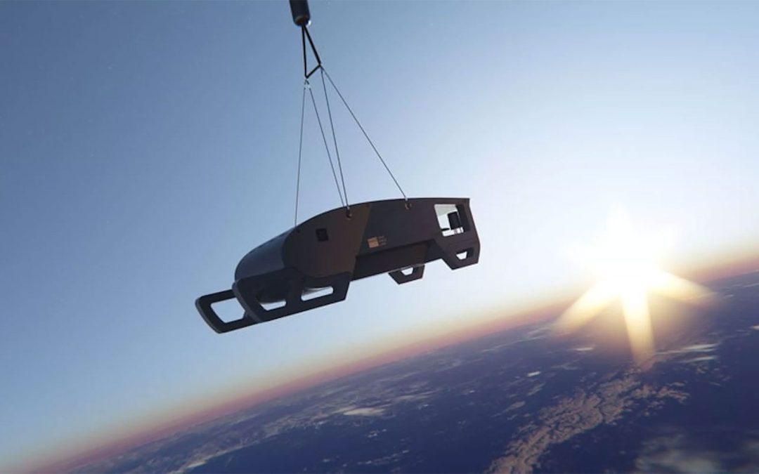
Brooklyn-based startup Near Space Labs has built a fleet of balloon-deployed imaging robots called Swifts. These lightweight, zero-emission devices ride to the stratosphere—roughly 60,000 to 85,000 feet above Earth—where they photograph vast areas in striking detail.
Key facts, confirmed by the company’s own releases and independent coverage:
- Nationwide network: As of late 2024, Near Space Labs announced a coast-to-coast deployment of Swifts, establishing what it calls the first network of stratospheric robots covering the continental U.S.
- Ultra-high resolution: Their imagery now reaches 7 cm resolution—sharp enough to see individual roof shingles and small objects—on par with or better than traditional aerial surveys.
- Huge coverage per flight: A single Swift can photograph up to 1,000 square kilometers per flight—roughly the size of New York City’s five boroughs.
- “800,000 drones” equivalent: Near Space Labs’ CEO has repeatedly said one Swift can capture in a single flight what it would take about 800,000 drones to collect, a claim echoed in investor materials, news coverage and industry interviews.
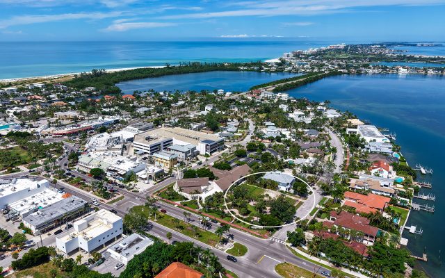
In other words: instead of sending out armies of drones or slow-moving planes, insurers can now get frequent, top-down, ultra-detailed imagery of entire metro areas, including coastal communities like Sarasota-Bradenton, from an altitude higher than commercial jets.
Why Insurers Are So Interested
The timing of this technology is not an accident. The U.S. homeowners insurance market has been under intense pressure.
- In 2023, U.S. homeowners insurers posted a net combined ratio of about 110.5—meaning they paid out more in claims and expenses than they collected in premiums—marking their worst underwriting performance in over a decade. Net losses and loss-adjustment expenses topped $101 billion.
- A U.S. Senate Budget Committee investigation found that between 2018 and 2023, nearly 2 million homeowners’ policies were non-renewed or dropped, with climate-driven risk cited as a central driver.
- Climate-amplified disasters continue to escalate losses. Hurricanes Helene and Milton alone are estimated to have caused tens of billions in insured damage and far greater total economic losses in 2024.
At the same time, large carriers have reduced their presence or tightened underwriting in high-risk states such as Florida, California and Texas—places where many of the most desirable coastal homes are located.
From the insurers’ perspective, better data is the path to staying in these markets rather than exiting them:
- High-frequency, high-resolution imagery allows them to see exactly what they’re insuring—roof condition, vegetation near structures, recent upgrades, and post-storm damage—without relying on outdated imagery or infrequent in-person inspections.
- Companies like Near Space Labs market this as a backbone for “climate resilience”—a way to replace broad, model-only risk assumptions with data showing the real, current state of each property.
For homeowners and buyers in Sarasota’s premium coastal neighborhoods, the hopeful version of this story is simple: better data could help keep insurance available in locations where it might otherwise become prohibitively expensive or vanish altogether.
The Privacy and Fairness Debate
The same clarity that insurers prize also raises hard questions.
Recent reporting has documented balloon flights over the Phoenix metro area, with journalists identifying multiple aircraft using Near Space Labs’ callsign in a single week.
Concerns fall into three main buckets:
Surveillance vs. assessment
- Swifts capture straight-down images rather than angled, zoom-lens views. Near Space Labs’ CEO argues this overhead perspective is more privacy-preserving than street-level imagery.
- Nonetheless, the imagery is detailed enough to spot a missing shingle or overgrown tree limb—small issues that might trigger premium hikes or non-renewals if interpreted as elevated risk.
Transparency and consent
- At the federal level, there are no comprehensive rules specifically governing how private insurers can use aerial imagery (from drones, planes, satellites or stratospheric balloons) in underwriting and claims decisions.
- Because these images are collected by private companies—not government agencies—many traditional constitutional protections around surveillance may not apply in the same way, a point repeatedly raised by civil-liberties advocates.
Ability to challenge errors
- Homeowners have reported policies being non-renewed based on aerial photos that misinterpreted algae, debris or temporary conditions as long-term risk.
- Without guaranteed access to the images or a clear dispute process, it can be difficult for a homeowner to correct a mistake before losing coverage.
These are not abstract worries. A climate-risk analysis found that more than 15% of properties in Maricopa County, Arizona (Phoenix) are at risk of higher premiums or canceled policies due to rising wildfire exposure—a key backdrop for why insurers are embracing tools like stratospheric imagery there.
How Lawmakers Are Responding
Regulation is starting to catch up—slowly.
- In California, Assembly Bill 75 would require insurers to give homeowners at least 30 days’ notice before conducting aerial inspections, and to provide copies of any images used in underwriting decisions. The bill has strong backing from the state’s insurance commissioner as a transparency and fairness measure.
- Other proposals, and guidance from regulators in states like California and Pennsylvania, are pushing for limits on how old imagery can be and when in-person inspections are still required.
The core idea emerging: aerial imagery isn’t going away, but homeowners should know when it’s being used, see what their insurer sees, and have a clear path to contest errors.
What This Means for Sarasota & Gulf-Coast Luxury Homes
For the Sarasota-Bradenton region, and especially the high-value homes we specialize in at the Laughlin Tanner Group, there are several practical implications.
1. Insurance is becoming part of the value story
In a world where insurance can make or break a transaction, insurability itself becomes a feature of the property.
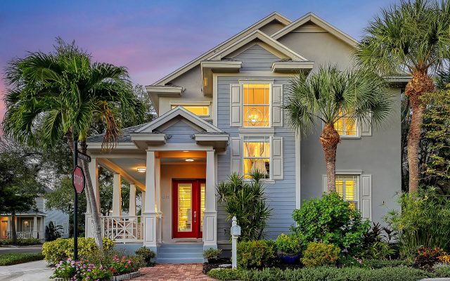
- Elevated design, hurricane-rated systems, and thoughtful siting don’t just look good; they show up in the data when an insurer reviews top-down imagery.
- Demonstrable resilience—new roofs, cleared defensible space, updated drainage—can help keep a home insurable when broader models flag the ZIP code as high risk.
2. “Hidden details” are less hidden
The same camera that verifies a new roof or upgraded windows can also see deferred maintenance:
- Missing shingles
- Clogged gutters
- Overhanging branches and unmanaged vegetation
In high-exposure states like Florida, small issues are more likely to be captured and analyzed at scale. Addressing them proactively is no longer just good stewardship; it’s risk management in anticipation of what the camera will see.
3. Market segmentation will sharpen
As insurers move from coarse hazard maps to fine-grained property-level data, we expect to see:
- Greater differentiation within the same neighborhood based on actual condition and mitigation measures.
- Premiums and availability that track specific improvements, not just location.
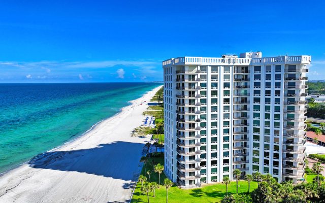
For buyers and sellers of premium homes, from downtown Sarasota condos to Longboat, Lido and Anna Maria Island properties, that can create a meaningful spread between otherwise similar addresses.
The Bottom Line
AI-enabled stratospheric imagery is not simply a technology story; it is reshaping the economics, accessibility, and privacy contours of homeownership, especially in coastal, climate-exposed markets.
For our clients at the Laughlin Tanner Group, the goal is straightforward: to pair the best of Sarasota’s lifestyle and architecture with a clear understanding of risk, insurance and resilience, so that your home isn’t just exceptional today, but well-positioned for the years ahead.